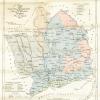
Map of Monmouthshire divided into mineral and agricultural districts (coloured), by Charles Hassall, 1811
Description
Map of Monmouthshire divided into mineral and agricultural districts (coloured), by Charles Hassall, 1811
More items with these tags
Related items


Contact Us
To request take down or report racist, offensive or otherwise harmful content.

You must be logged in to leave a comment